
SatAgro is a Polish agri-tech company based in Warsaw that helps farmers use satellite data to manage their fields in a precise and sustainable way. It started as a Polish start-up around 2015 and now supports hundreds of farms in Poland and other regions with digital tools for field monitoring.
The company’s main goal is to help farms save inputs like fertiliser and water while keeping yields high and protecting the environment. As one of the leading precision agriculture players in Poland, SatAgro is often chosen by growers who also work with drones and other smart farm tools, because it turns complex satellite data into simple maps and tasks that farmers can use every day.
Key Services Offered by SatAgro
- Satellite crop monitoring and health maps that show how plants grow in different parts of the field, helping farmers spot problems early and react in time.
- Variable rate application planning, which creates precise fertiliser and spraying maps so farmers can use less input in strong areas and more in weak spots, saving money and reducing waste.
- Historical field and weather analysis, giving access to past satellite images, soil maps, and climate data so farmers can plan rotations and investments with better knowledge.
- Integration with farm machinery and controllers, allowing maps from SatAgro to be exported to spreaders, sprayers, and other devices for smooth use in the field.
- Alerts, reporting, and consulting support, including alarms when key values change, simple reports, and expert help so users can understand data and improve yields and sustainability.
FAQs
What is SatAgro?
SatAgro is an online platform for precision farming that uses satellite images and agroanalytics to help farmers monitor crops, plan treatments, and optimise inputs.
How does SatAgro help farmers save money?
The platform creates variable rate maps and clear field zones so farmers can match fertiliser and chemicals to the real needs of the crop, often cutting input use while keeping or raising yields.
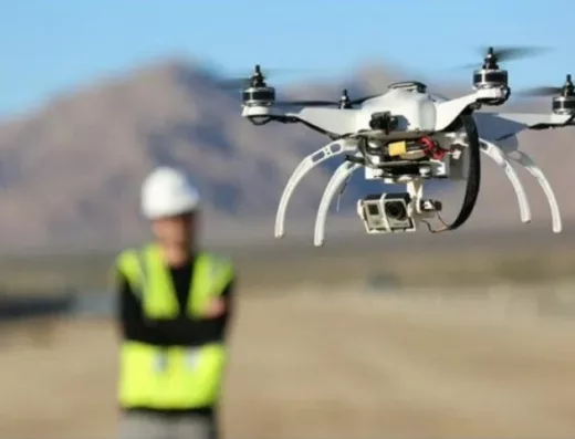
Is SatAgro useful if I already use agricultural drones?
Yes. Drones can give very detailed local data, while SatAgro provides regular wide-area satellite monitoring; together they give a fuller picture for better treatment plans.
Do I need special hardware to use SatAgro?
You mainly need a computer or tablet with internet to access the app, and for full automation you may also use compatible spreaders or sprayers that can read application maps.
Is SatAgro available only in Poland?
SatAgro was created in Poland and is well known there, but its satellite-based tools can support farms in other countries where the service is offered and satellite data is available.
Categories
Regions
Similar Listings


Add Review
Claim listing
Ashley earned her M.B.A. from The University of Texas at Dallas, where she gained a solid foundation in business strategy and management, further enhancing her ability to bridge the gap between technology and business needs.
Ashley has spent the past several years working in the IT industry, with a focus on AI innovations, AR, VR, Blockchain, and GPT technologies. She has held various positions in IT management, software development, and AI research, consistently delivering exceptional results and driving technological advancements.
Leave a Reply